
This years theme for NAIDOC week is “Always Was, Always Will Be”. I’m interested in finding ways to creatively and contemplatively explore what this means as a white-presenting Settler in this place.
I love old books and paper, I’m going to use some of these as a lens: First up is the Collins Australian Clear School Atlas New and Revised Edition.
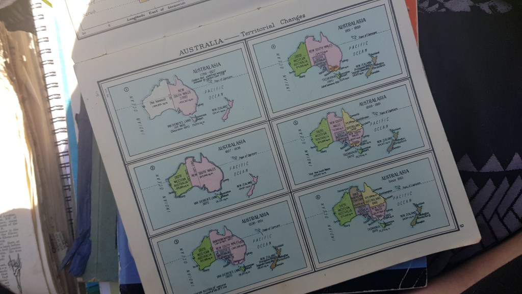
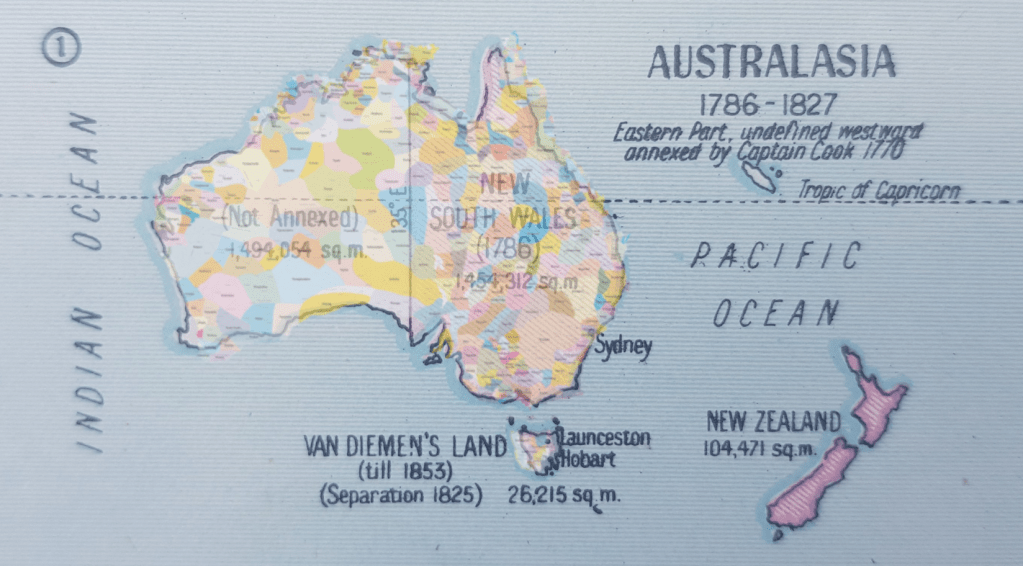
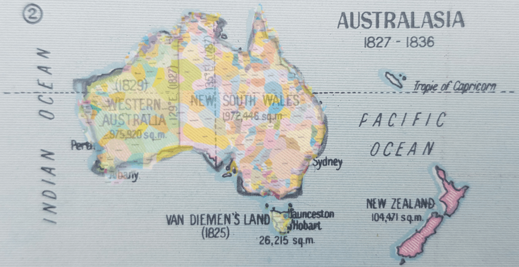
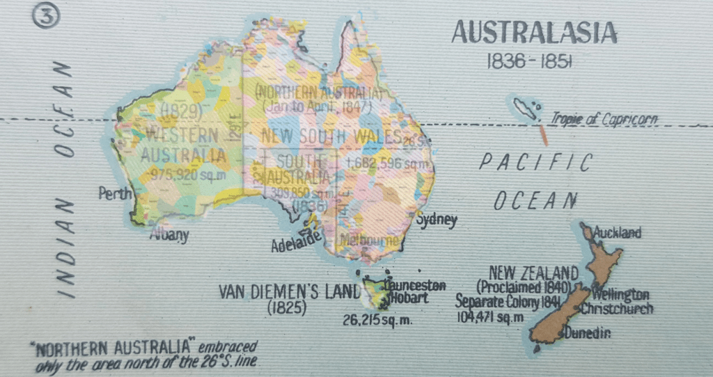
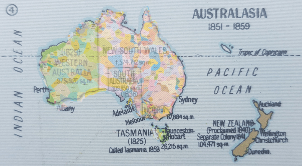
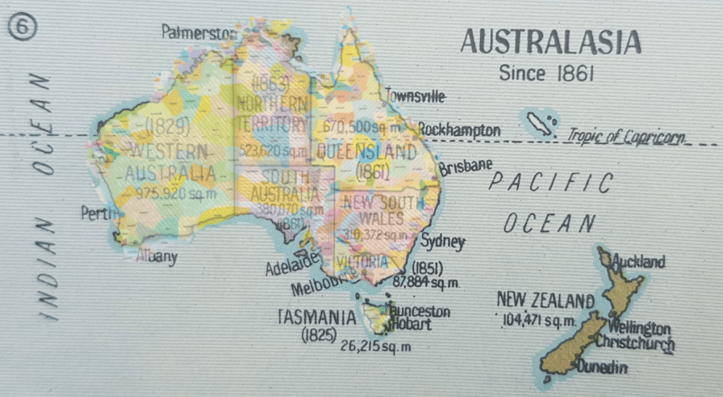
These maps show the territorial changes (6) between 1786 and 1861. Here they are shown with an overlay of the AIATSIS map of Indigenous Australia. It’s hard not to liken that to a shadow, a haunting overlay, crossing and connecting countries and communities across territorial lines drawn and re-drawn.
What arises when you look at these? Has your home country/town been in different states?

It’s important to understand that when you are speaking to an Aboriginal or Torres Strait person and recognise that their cultural tale is millenia-long that the image of Australia they might imagine is the reverse: Aboriginal land with state and territory lines superimposed on top. When Aboriginal and Torres Strait Island people say: “Always was, always will be, Aboriginal land” this is what they mean… these many countries and territories existed prior to 1786 and they are still here.

Yesterday, Gomeroi woman, Rachel McPhail, living on Wiradjuri country did a call out to challenge Australia Post to encourage Aussies to include the traditional Nation name in the extra address line when sending letters and packages. To support this idea, you can check traditional Nations at AIATSIS.gov.au.
